 vesseltracker.com
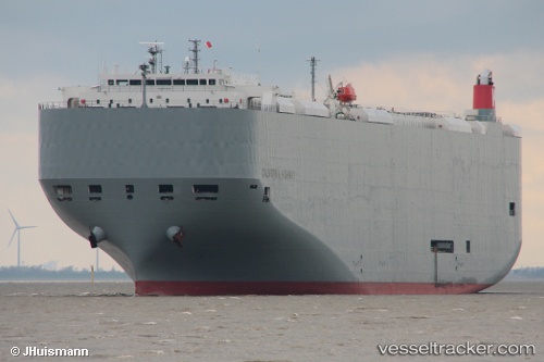
 California Highway
Current Status
Where is the vessel?
California Highway is currently in Near Derince, based on AIS data received less than 1h ago.
Latest AIS update:
Current position: 40.74752° N, 29.83660° E (Near Derince)
Average speed (last 7 days): Loading…
Average speed (last 30 days): Loading…
Vessel profile: California Highway is a Vehicles Carrier with dimensions 200m x 32m.
This page combines live AIS, route history, probable destination signals, nearby traffic, and port activity for practical vessel monitoring.
The current position of vessel California Highway is 40.74752 lat / 29.83660 lng. Updated: 2026-03-30 14:00:38 UTCNearest reference points:
- Near Derince
- Near AUTOPORT
- Near KORFEZ
Currently sailing under the flag of Panama ![]()
California Highway built in 2010 year
Deadweight:
18644 tDetails:
Live Vessel California Highway Analytics (details, animations, etc.)
Recent AIS points (UTC):
2026-03-30 07:48:35 UTC · 40.74752, 29.83660 · SOG 0 kn · COG 264°2026-03-30 09:21:35 UTC · 40.74752, 29.83659 · SOG 0 kn · COG 264°
2026-03-30 12:00:35 UTC · 40.74752, 29.83660 · SOG 0 kn · COG 264°
2026-03-30 14:00:38 UTC · 40.74752, 29.83660 · SOG 0 kn · COG 264°