 vesseltracker.com
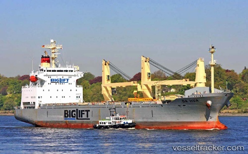
 Da Hua
Current Status
Where is the vessel?
Da Hua is currently in 27 nm SE of Hua-Lien Kang, based on AIS data received about 1h ago.
Latest AIS update:
Current position: 23.68620° N, 122.00554° E (27 nm SE of Hua-Lien Kang)
Average speed (last 7 days): Loading…
Average speed (last 30 days): Loading…
Vessel profile: Da Hua is a General Cargo Ship with dimensions 153m x 153m.
This page combines live AIS, route history, probable destination signals, nearby traffic, and port activity for practical vessel monitoring.
The current position of vessel Da Hua is 23.68620 lat / 122.00554 lng. Updated: 2026-04-24 19:29:19 UTCNearest reference points:
- 26 nm E of Hua-Lien Kang
- Near SUAO
- 55 nm S of Hua-Lien Kang
Currently sailing under the flag of Panama ![]()
Da Hua built in 1998 year
Deadweight:
16957 tDetails:
Live Vessel Da Hua Analytics (details, animations, etc.)
Recent AIS points (UTC):
2026-04-24 16:36:20 UTC · 24.16784, 122.20589 · SOG 10.3 kn · COG 184°2026-04-24 17:53:00 UTC · 23.95820, 122.11556 · SOG 10.8 kn · COG 205°
2026-04-24 19:25:10 UTC · 23.69840, 122.01002 · SOG 11.1 kn · COG 190°
2026-04-24 19:29:19 UTC · 23.68620, 122.00554 · SOG 11.1 kn · COG 189°