 vesseltracker.com
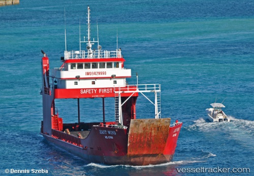
East Wind
Current StatusWhere is the vessel?
East Wind is currently in Near Marsh Harbour, based on AIS data received less than 1h ago.
Latest AIS update:
Current position: 26.46810° N, 76.90418° W (Near Marsh Harbour)
Average speed (last 7 days): Loading…
Average speed (last 30 days): Loading…
Vessel profile: East Wind is a Ro Ro Cargo Ship with dimensions 11m x 54m.
This page combines live AIS, route history, probable destination signals, nearby traffic, and port activity for practical vessel monitoring.
The current position of vessel East Wind is 26.46810 lat / -76.90418 lng. Updated: 2026-04-28 23:53:04 UTCNearest reference points:
- Near Green Turtle Cay
- 27 nm SE of Gorda Cay
- Near Harbour Island
Details:
Live Vessel East Wind Analytics (details, animations, etc.)
Recent AIS points (UTC):
2026-04-28 19:37:23 UTC · 26.61948, -77.08235 · SOG 6.6 kn · COG -1°2026-04-28 21:24:08 UTC · 26.54405, -77.06331 · SOG 0 kn · COG -1°
2026-04-28 22:04:03 UTC · 26.57245, -77.06253 · SOG 8.6 kn · COG -1°
2026-04-28 23:53:04 UTC · 26.46810, -76.90418 · SOG 10 kn · COG -1°