 vesseltracker.com
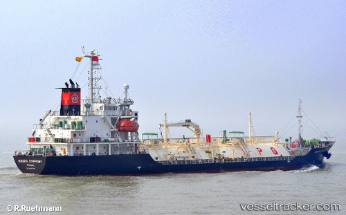
 LADY THALASSA
Current Status
Where is the vessel?
LADY THALASSA is currently in Near MAILIAO, based on AIS data received about 1h ago.
Latest AIS update:
Current position: 23.77619° N, 120.17153° E (Near MAILIAO)
Average speed (last 7 days): Loading…
Average speed (last 30 days): Loading…
Vessel profile: LADY THALASSA is a LPG Tanker with dimensions 15m x 95m.
This page combines live AIS, route history, probable destination signals, nearby traffic, and port activity for practical vessel monitoring.
The current position of vessel LADY THALASSA is 23.77619 lat / 120.17153 lng. Updated: 2026-05-01 10:29:39 UTCNearest reference points:
- Near MAILIAO
- Near Lung-men
- Near TAICHUNG
Currently sailing under the flag of Panama ![]()
LADY THALASSA built in 2008 year
Deadweight:
3161 tDetails:
Live Vessel LADY THALASSA Analytics (details, animations, etc.)
Recent AIS points (UTC):
2026-05-01 07:26:42 UTC · 23.77618, 120.17151 · SOG 0 kn · COG 149°2026-05-01 07:56:39 UTC · 23.77616, 120.17154 · SOG 0 kn · COG 149°
2026-05-01 09:32:41 UTC · 23.77621, 120.17153 · SOG 0 kn · COG 149°
2026-05-01 10:29:39 UTC · 23.77619, 120.17153 · SOG 0 kn · COG 149°