 vesseltracker.com
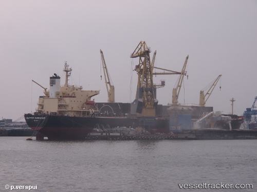
 BAODA 17
Current Status
Where is the vessel?
BAODA 17 is currently in Near AL ADABIYAH, based on AIS data received about 2h ago.
Latest AIS update:
Current position: 29.87804° N, 32.47576° E (Near AL ADABIYAH)
Average speed (last 7 days): Loading…
Average speed (last 30 days): Loading…
Vessel profile: BAODA 17 is a Bulk Carrier with dimensions 32m x 190m.
This page combines live AIS, route history, probable destination signals, nearby traffic, and port activity for practical vessel monitoring.
The current position of vessel BAODA 17 is 29.87804 lat / 32.47576 lng. Updated: 2026-05-15 10:54:13 UTCNearest reference points:
- Near AL ADABIYAH
- Near Bur Ibrahim
- Near As Suways (Suez)
Currently sailing under the flag of Panama ![]()
BAODA 17 built in 2004 year
Deadweight:
52483 tDetails:
Live Vessel BAODA 17 Analytics (details, animations, etc.)
Recent AIS points (UTC):
2026-05-15 07:21:05 UTC · 29.87804, 32.47574 · SOG 0 kn · COG 335°2026-05-15 08:21:07 UTC · 29.87804, 32.47575 · SOG 0 kn · COG 335°
2026-05-15 10:24:11 UTC · 29.87806, 32.47575 · SOG 0 kn · COG 335°
2026-05-15 10:54:13 UTC · 29.87804, 32.47576 · SOG 0 kn · COG 335°