 vesseltracker.com
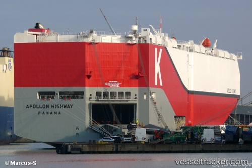
 Apollon Highway
Current Status
Where is the vessel?
Apollon Highway is currently in 174 nm SE of Sundance, based on AIS data received less than 1h ago.
Latest AIS update:
Current position: 22.17333° N, 132.14159° W (174 nm SE of Sundance)
Average speed (last 7 days): Loading…
Average speed (last 30 days): Loading…
Vessel profile: Apollon Highway is a Vehicles Carrier with dimensions 200m x 40m.
This page combines live AIS, route history, probable destination signals, nearby traffic, and port activity for practical vessel monitoring.
The current position of vessel Apollon Highway is 22.17333 lat / -132.14159 lng. Updated: 2026-05-15 03:22:49 UTCCurrently sailing under the flag of Panama ![]()
Details:
Live Vessel Apollon Highway Analytics (details, animations, etc.)
Recent AIS points (UTC):
2026-05-14 22:19:19 UTC · 22.23312, -133.52029 · SOG 15.1 kn · COG 91°2026-05-15 00:04:20 UTC · 22.21297, -133.04510 · SOG 15 kn · COG 91°
2026-05-15 01:20:06 UTC · 22.19887, -132.70058 · SOG 15.2 kn · COG 92°
2026-05-15 03:22:49 UTC · 22.17333, -132.14159 · SOG 15.1 kn · COG 91°