 vesseltracker.com
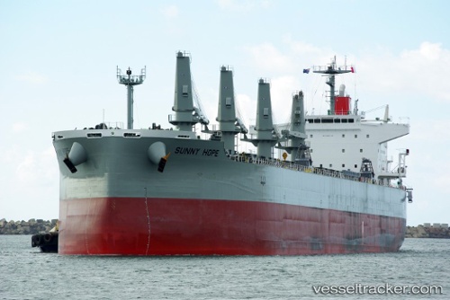
Sunny Hope
Current StatusWhere is the vessel?
Sunny Hope is currently in 13 nm N of Puerto Colombia, based on AIS data received less than 1h ago.
Latest AIS update:
Current position: 11.20928° N, 74.92292° W (13 nm N of Puerto Colombia)
Average speed (last 7 days): Loading…
Average speed (last 30 days): Loading…
Vessel profile: Sunny Hope is a Bulk Carrier with dimensions 32m x 194m.
This page combines live AIS, route history, probable destination signals, nearby traffic, and port activity for practical vessel monitoring.
The current position of vessel Sunny Hope is 11.20928 lat / -74.92292 lng. Updated: 2026-05-02 21:28:30 UTCNearest reference points:
- Near Santa Marta
- 18 nm N of Santa Marta
- Near Sociedad Portuaria Regional Cartagena
Details:
Live Vessel Sunny Hope Analytics (details, animations, etc.)
Recent AIS points (UTC):
2026-05-02 17:28:10 UTC · 11.19577, -74.58320 · SOG 12 kn · COG 264°2026-05-02 19:25:09 UTC · 11.29600, -74.91013 · SOG 3.6 kn · COG 346°
2026-05-02 19:25:39 UTC · 11.29633, -74.91050 · SOG 3.5 kn · COG 348°
2026-05-02 21:28:30 UTC · 11.20928, -74.92292 · SOG 7.9 kn · COG 162°