 vesseltracker.com
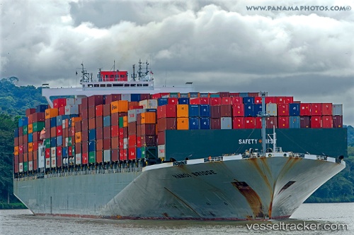
 Hanoi Bridge
Current Status
Where is the vessel?
Hanoi Bridge is currently in Open sea (no nearby ports in database), based on AIS data received about 20d ago.
Latest AIS update:
Current position: 46.85251° S, 122.64525° E (Open sea (no nearby ports in database))
Average speed (last 7 days): Loading…
Average speed (last 30 days): Loading…
Vessel profile: Hanoi Bridge is a Container Ship with dimensions 335m x 46m.
This page combines live AIS, route history, probable destination signals, nearby traffic, and port activity for practical vessel monitoring.
The current position of vessel Hanoi Bridge is -46.85251 lat / 122.64525 lng. Updated: 2026-04-24 00:18:13 UTCNearest reference points:
- Open sea (no nearby ports in database)
Currently sailing under the flag of Panama ![]()
Hanoi Bridge built in 2013 year
Deadweight:
96980 tDetails:
Live Vessel Hanoi Bridge Analytics (details, animations, etc.)
Recent AIS points (UTC):
2026-04-24 00:18:13 UTC · -46.85251, 122.64525 · SOG 0.6 kn · COG -1°