 vesseltracker.com
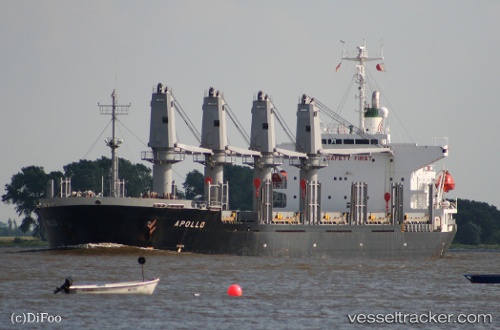
Sea Adelaide
Current StatusWhere is the vessel?
Sea Adelaide is currently in 13 nm NW of Barora Ite Island, based on AIS data received less than 1h ago.
Latest AIS update:
Current position: 7.41270° S, 158.26868° E (13 nm NW of Barora Ite Island)
Average speed (last 7 days): Loading…
Average speed (last 30 days): Loading…
Vessel profile: Sea Adelaide is a Bulk Carrier with dimensions 27m x 169m.
This page combines live AIS, route history, probable destination signals, nearby traffic, and port activity for practical vessel monitoring.
The current position of vessel Sea Adelaide is -7.41270 lat / 158.26868 lng. Updated: 2026-05-15 10:05:11 UTCDetails:
Live Vessel Sea Adelaide Analytics (details, animations, etc.)
Recent AIS points (UTC):
2026-05-15 06:26:04 UTC · -7.41265, 158.26871 · SOG 0 kn · COG 108°2026-05-15 07:23:06 UTC · -7.41268, 158.26871 · SOG 0 kn · COG 109°
2026-05-15 09:29:10 UTC · -7.41270, 158.26872 · SOG 0 kn · COG 110°
2026-05-15 10:05:11 UTC · -7.41270, 158.26868 · SOG 0 kn · COG 115°