 vesseltracker.com
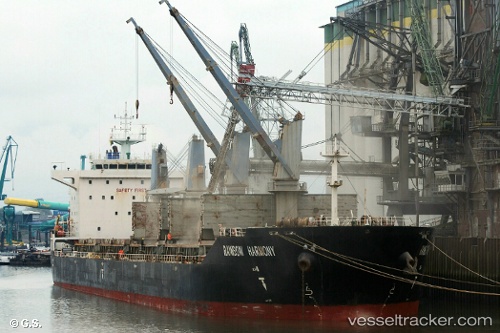
Rainbow Harmony
Current StatusWhere is the vessel?
Rainbow Harmony is currently in 107 nm S of Kumai, based on AIS data received less than 1h ago.
Latest AIS update:
Current position: 4.41833° S, 112.29333° E (107 nm S of Kumai)
Average speed (last 7 days): Loading…
Average speed (last 30 days): Loading…
Vessel profile: Rainbow Harmony is a Bulk Carrier with dimensions 28m x 180m.
This page combines live AIS, route history, probable destination signals, nearby traffic, and port activity for practical vessel monitoring.
The current position of vessel Rainbow Harmony is -4.41833 lat / 112.29333 lng. Updated: 2026-04-25 22:23:26 UTCNearest reference points:
- 60 nm NW of Camar Marine Terminal
- 50 nm N of Camar Marine Terminal
- 68 nm NW of Gagak Rimang Fso
Details:
Live Vessel Rainbow Harmony Analytics (details, animations, etc.)
Recent AIS points (UTC):
2026-04-25 18:32:27 UTC · -4.19667, 111.54667 · SOG 11 kn · COG -1°2026-04-25 19:26:25 UTC · -4.25667, 111.71333 · SOG 11 kn · COG -1°
2026-04-25 22:11:28 UTC · -4.40667, 112.25500 · SOG 12 kn · COG -1°
2026-04-25 22:23:26 UTC · -4.41833, 112.29333 · SOG 12 kn · COG -1°