 vesseltracker.com
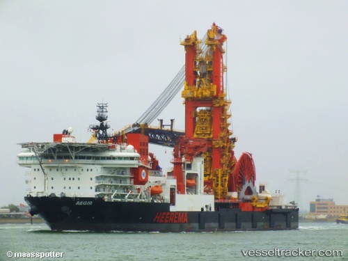
Aegir
Current StatusWhere is the vessel?
Aegir is currently in 377 nm S of Diego Garcia, based on AIS data received about 1h ago.
Latest AIS update:
Current position: 13.28655° S, 74.41114° E (377 nm S of Diego Garcia)
Average speed (last 7 days): Loading…
Average speed (last 30 days): Loading…
Vessel profile: Aegir is a Pipe Layer with dimensions 46m x 209m.
This page combines live AIS, route history, probable destination signals, nearby traffic, and port activity for practical vessel monitoring.
The current position of vessel Aegir is -13.28655 lat / 74.41114 lng. Updated: 2026-05-14 13:39:53 UTCNearest reference points:
- Open sea, approx. 404 nm off the nearest listed port
- Open sea, approx. 409 nm off the nearest listed port
- Open sea, approx. 405 nm off the nearest listed port
Details:
Live Vessel Aegir Analytics (details, animations, etc.)
Recent AIS points (UTC):
2026-05-14 09:50:02 UTC · -13.60015, 73.93331 · SOG 8.7 kn · COG 61°2026-05-14 12:14:52 UTC · -13.40090, 74.23383 · SOG 8.9 kn · COG 64°
2026-05-14 13:15:55 UTC · -13.31817, 74.36160 · SOG 8.5 kn · COG 61°
2026-05-14 13:39:53 UTC · -13.28655, 74.41114 · SOG 8.9 kn · COG 62°