 vesseltracker.com
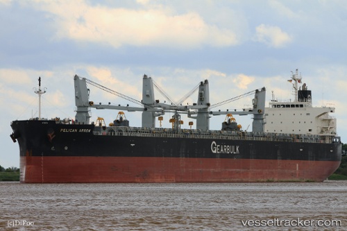
 Pelican Arrow
Current Status
Where is the vessel?
Pelican Arrow is currently in Open sea (no nearby ports in database), based on AIS data received less than 1h ago.
Latest AIS update:
Current position: 14.84012° S, 75.81925° E (Open sea (no nearby ports in database))
Average speed (last 7 days): Loading…
Average speed (last 30 days): Loading…
Vessel profile: Pelican Arrow is a General Cargo Ship with dimensions 200m x 32m.
This page combines live AIS, route history, probable destination signals, nearby traffic, and port activity for practical vessel monitoring.
The current position of vessel Pelican Arrow is -14.84012 lat / 75.81925 lng. Updated: 2026-05-15 13:42:56 UTCNearest reference points:
- Open sea (no nearby ports in database)
- Open sea, approx. 452 nm off the nearest listed port
- Open sea, approx. 441 nm off the nearest listed port
Currently sailing under the flag of Panama ![]()
Pelican Arrow built in 2011 year
Deadweight:
62942 tDetails:
Live Vessel Pelican Arrow Analytics (details, animations, etc.)
Recent AIS points (UTC):
2026-05-15 10:07:30 UTC · -14.93167, 76.47500 · SOG 11 kn · COG -1°2026-05-15 10:38:21 UTC · -14.91870, 76.38090 · SOG 10.8 kn · COG 278°
2026-05-15 11:33:36 UTC · -14.89443, 76.21337 · SOG 10.8 kn · COG 279°
2026-05-15 13:42:56 UTC · -14.84012, 75.81925 · SOG 11 kn · COG 278°