 vesseltracker.com
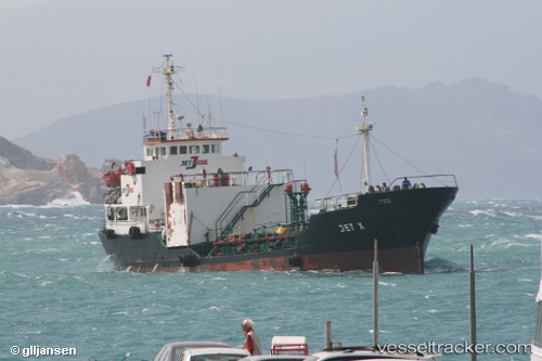
Mt Turu
Current StatusWhere is the vessel?
Mt Turu is currently in 125 nm E of SUR, based on AIS data received less than 1h ago.
Latest AIS update:
Current position: 22.22016° N, 61.74828° E (125 nm E of SUR)
Average speed (last 7 days): Loading…
Average speed (last 30 days): Loading…
Vessel profile: Mt Turu is a Oil Products Tanker with dimensions 9m x 52m.
This page combines live AIS, route history, probable destination signals, nearby traffic, and port activity for practical vessel monitoring.
The current position of vessel Mt Turu is 22.22016 lat / 61.74828 lng. Updated: 2026-05-14 16:45:39 UTCNearest reference points:
- 120 nm E of SUR
- 96 nm E of SUR
- 171 nm E of SUR
Details:
Live Vessel Mt Turu Analytics (details, animations, etc.)
Recent AIS points (UTC):
2026-05-14 13:15:39 UTC · 22.24149, 61.61570 · SOG 2.5 kn · COG 139°2026-05-14 13:42:39 UTC · 22.23961, 61.63468 · SOG 2.3 kn · COG 147°
2026-05-14 15:03:14 UTC · 22.23167, 61.68667 · SOG 2 kn · COG -1°
2026-05-14 16:45:39 UTC · 22.22016, 61.74828 · SOG 1.9 kn · COG 141°