 vesseltracker.com
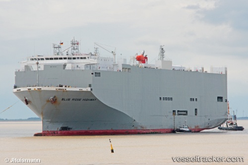
Blue Ridge Highway
Current StatusWhere is the vessel?
Blue Ridge Highway is currently in 189 nm SW of Santa Rita, based on AIS data received less than 1h ago.
Latest AIS update:
Current position: 11.86905° N, 147.50230° W (189 nm SW of Santa Rita)
Average speed (last 7 days): Loading…
Average speed (last 30 days): Loading…
Vessel profile: Blue Ridge Highway is a Vehicles Carrier with dimensions 31m x 180m.
This page combines live AIS, route history, probable destination signals, nearby traffic, and port activity for practical vessel monitoring.
The current position of vessel Blue Ridge Highway is 11.86905 lat / -147.50230 lng. Updated: 2026-05-16 13:22:18 UTCDetails:
Live Vessel Blue Ridge Highway Analytics (details, animations, etc.)
Recent AIS points (UTC):
2026-05-16 10:36:43 UTC · 11.54981, -146.65846 · SOG 19.2 kn · COG 294°2026-05-16 12:03:51 UTC · 11.71766, -147.10188 · SOG 19.1 kn · COG 293°
2026-05-16 13:05:06 UTC · 11.83581, -147.41411 · SOG 19.3 kn · COG 294°
2026-05-16 13:22:18 UTC · 11.86905, -147.50230 · SOG 19.5 kn · COG 293°