 vesseltracker.com
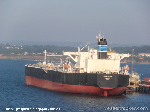
 Karavas
Current Status
Where is the vessel?
Karavas is currently in 252 nm N of Saint George, based on AIS data received about 1h ago.
Latest AIS update:
Current position: 36.33667° N, 62.98500° W (252 nm N of Saint George)
Average speed (last 7 days): Loading…
Average speed (last 30 days): Loading…
Vessel profile: Karavas is a Crude Oil Tanker with dimensions 237m x 237m.
This page combines live AIS, route history, probable destination signals, nearby traffic, and port activity for practical vessel monitoring.
The current position of vessel Karavas is 36.33667 lat / -62.98500 lng. Updated: 2026-04-30 07:50:51 UTCCurrently sailing under the flag of Panama ![]()
Karavas built in 2010 year
Deadweight:
107505 tDetails:
Live Vessel Karavas Analytics (details, animations, etc.)
Recent AIS points (UTC):
2026-04-30 04:05:52 UTC · 35.95167, -63.69333 · SOG 10 kn · COG -1°2026-04-30 04:17:49 UTC · 35.97167, -63.65667 · SOG 11 kn · COG -1°
2026-04-30 07:44:51 UTC · 36.32667, -63.00500 · SOG 11 kn · COG -1°
2026-04-30 07:50:51 UTC · 36.33667, -62.98500 · SOG 10 kn · COG -1°