 vesseltracker.com
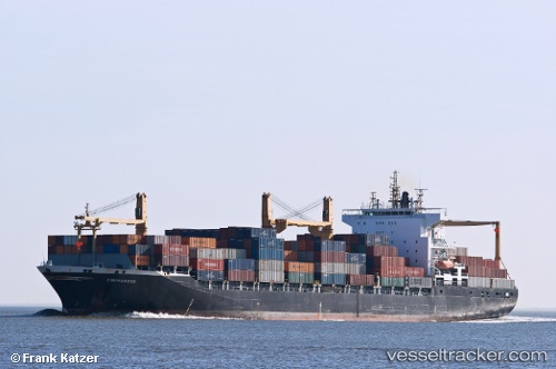
 TSS SHAMS
Current Status
Where is the vessel?
TSS SHAMS is currently in 57 nm S of Jafarabad, based on AIS data received about 1h ago.
Latest AIS update:
Current position: 19.90629° N, 71.25163° E (57 nm S of Jafarabad)
Average speed (last 7 days): Loading…
Average speed (last 30 days): Loading…
Vessel profile: TSS SHAMS is a Container Ship with dimensions 32m x 208m.
This page combines live AIS, route history, probable destination signals, nearby traffic, and port activity for practical vessel monitoring.
The current position of vessel TSS SHAMS is 19.90629 lat / 71.25163 lng. Updated: 2026-05-14 10:25:43 UTCNearest reference points:
- 33 nm S of Mul Dwårka
- Near Jafarabad
- 17 nm SE of Port Pipavav
Currently sailing under the flag of Panama ![]()
TSS SHAMS built in 2004 year
Deadweight:
35814 tDetails:
Live Vessel TSS SHAMS Analytics (details, animations, etc.)
Recent AIS points (UTC):
2026-05-14 07:56:19 UTC · 19.91788, 70.89188 · SOG 8.2 kn · COG 90°2026-05-14 08:12:09 UTC · 19.91657, 70.93022 · SOG 8.1 kn · COG 90°
2026-05-14 09:55:39 UTC · 19.90806, 71.17523 · SOG 8.7 kn · COG 85°
2026-05-14 10:25:43 UTC · 19.90629, 71.25163 · SOG 8.7 kn · COG 101°