 vesseltracker.com
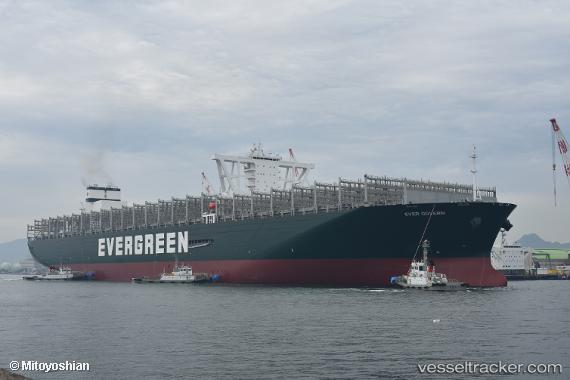
 Ever Govern
Current Status
Where is the vessel?
Ever Govern is currently in 16 nm SE of Kenton-on-Sea, based on AIS data received about 1h ago.
Latest AIS update:
Current position: 33.88572° S, 26.83798° E (16 nm SE of Kenton-on-Sea)
Average speed (last 7 days): Loading…
Average speed (last 30 days): Loading…
Vessel profile: Ever Govern is a Container Ship with dimensions 400m x 59m.
This page combines live AIS, route history, probable destination signals, nearby traffic, and port activity for practical vessel monitoring.
The current position of vessel Ever Govern is -33.88572 lat / 26.83798 lng. Updated: 2026-04-29 23:05:20 UTCNearest reference points:
- Near Deal Party
- 21 nm S of Mount Pleasant
Currently sailing under the flag of Panama ![]()
Details:
Live Vessel Ever Govern Analytics (details, animations, etc.)
Recent AIS points (UTC):
2026-04-29 19:27:01 UTC · -33.43640, 27.49991 · SOG 11.1 kn · COG 223°2026-04-29 19:53:20 UTC · -33.49545, 27.42661 · SOG 11.9 kn · COG 225°
2026-04-29 22:16:52 UTC · -33.78451, 27.00587 · SOG 12.1 kn · COG 232°
2026-04-29 23:05:20 UTC · -33.88572, 26.83798 · SOG 12.8 kn · COG 239°