 vesseltracker.com
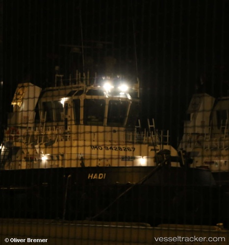
Hadi
Current StatusWhere is the vessel?
Hadi is currently in 19 nm W of Abu Dhabi, based on AIS data received about 2h ago.
Latest AIS update:
Current position: 24.56768° N, 53.97901° E (19 nm W of Abu Dhabi)
Average speed (last 7 days): Loading…
Average speed (last 30 days): Loading…
Vessel profile: Hadi is a Offshore Tug Supply Ship with dimensions 11m x 45m.
This page combines live AIS, route history, probable destination signals, nearby traffic, and port activity for practical vessel monitoring.
The current position of vessel Hadi is 24.56768 lat / 53.97901 lng. Updated: 2026-05-13 19:52:59 UTCNearest reference points:
- Near Esnnad
- Near KHALIFA
- 11 nm SW of Fateh Terminal
Details:
Live Vessel Hadi Analytics (details, animations, etc.)
Recent AIS points (UTC):
2026-05-13 16:45:39 UTC · 24.54353, 54.00432 · SOG 4.2 kn · COG 1°2026-05-13 18:25:58 UTC · 24.59593, 53.97150 · SOG 0.4 kn · COG 43°
2026-05-13 18:33:49 UTC · 24.59920, 53.97291 · SOG 1.3 kn · COG 16°
2026-05-13 19:52:59 UTC · 24.56768, 53.97901 · SOG 0 kn · COG 171°