 vesseltracker.com
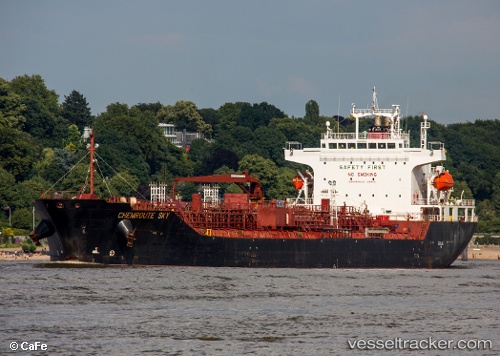
Chemroute Sky
Current StatusWhere is the vessel?
Chemroute Sky is currently in 58 nm S of Abakaliki, based on AIS data received about 3h ago.
Latest AIS update:
Current position: 5.38545° N, 86.15856° E (58 nm S of Abakaliki)
Average speed (last 7 days): Loading…
Average speed (last 30 days): Loading…
Vessel profile: Chemroute Sky is a Chemical Oil Products Tanker with dimensions 26m x 156m.
This page combines live AIS, route history, probable destination signals, nearby traffic, and port activity for practical vessel monitoring.
The current position of vessel Chemroute Sky is 5.38545 lat / 86.15856 lng. Updated: 2026-05-14 11:51:39 UTCNearest reference points:
- 23 nm S of Abakaliki
- 46 nm SW of Abakaliki
- 127 nm W of Abakaliki
Details:
Live Vessel Chemroute Sky Analytics (details, animations, etc.)
Recent AIS points (UTC):
2026-05-14 10:04:09 UTC · 5.40574, 86.48028 · SOG 10.9 kn · COG 262°2026-05-14 11:34:50 UTC · 5.38829, 86.20940 · SOG 10.9 kn · COG 263°
2026-05-14 11:51:39 UTC · 5.38545, 86.15856 · SOG 10.9 kn · COG 263°
2026-05-14 11:51:39 UTC · 5.38545, 86.15856 · SOG 10.9 kn · COG 263°