 vesseltracker.com
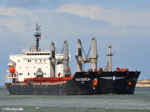
 ELINA II
Current Status
Where is the vessel?
ELINA II is currently in Near Chittagong, based on AIS data received less than 1h ago.
Latest AIS update:
Current position: 22.23136° N, 91.74629° E (Near Chittagong)
Average speed (last 7 days): Loading…
Average speed (last 30 days): Loading…
Vessel profile: ELINA II is a Bulk Carrier with dimensions 32m x 190m.
This page combines live AIS, route history, probable destination signals, nearby traffic, and port activity for practical vessel monitoring.
The current position of vessel ELINA II is 22.23136 lat / 91.74629 lng. Updated: 2026-05-15 00:00:56 UTCNearest reference points:
- Near Chittagong
- 12 nm NW of Chattogram
- 23 nm NW of Cox's Bazar
Currently sailing under the flag of Panama ![]()
ELINA II built in 2008 year
Deadweight:
53100 tDetails:
Live Vessel ELINA II Analytics (details, animations, etc.)
Recent AIS points (UTC):
2026-05-14 19:27:56 UTC · 22.23088, 91.74688 · SOG 0.1 kn · COG 352°2026-05-14 21:51:59 UTC · 22.23079, 91.74700 · SOG 0.1 kn · COG 346°
2026-05-14 22:39:55 UTC · 22.23094, 91.74700 · SOG 0 kn · COG 349°
2026-05-15 00:00:56 UTC · 22.23136, 91.74629 · SOG 0.1 kn · COG 14°