 vesseltracker.com
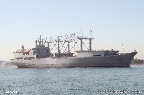
Curtiss
Current StatusWhere is the vessel?
Curtiss is currently in Near Rivergate, based on AIS data received less than 1h ago.
Latest AIS update:
Current position: 45.64553° N, 122.73452° W (Near Rivergate)
Average speed (last 7 days): Loading…
Average speed (last 30 days): Loading…
Vessel profile: Curtiss is a General Cargo Ship with dimensions 27m x 183m.
This page combines live AIS, route history, probable destination signals, nearby traffic, and port activity for practical vessel monitoring.
The current position of vessel Curtiss is 45.64553 lat / -122.73452 lng. Updated: 2026-05-14 07:13:56 UTCNearest reference points:
- Near Linnton
- Near LONGVIEW
- Near Astoria
Details:
Live Vessel Curtiss Analytics (details, animations, etc.)
Recent AIS points (UTC):
2026-05-14 03:28:58 UTC · 45.64556, -122.73455 · SOG 0 kn · COG 110°2026-05-14 05:00:50 UTC · 45.64500, -122.73333 · SOG 0 kn · COG -1°
2026-05-14 06:06:49 UTC · 45.64500, -122.73333 · SOG 0 kn · COG -1°
2026-05-14 07:13:56 UTC · 45.64553, -122.73452 · SOG 0 kn · COG 110°