 vesseltracker.com
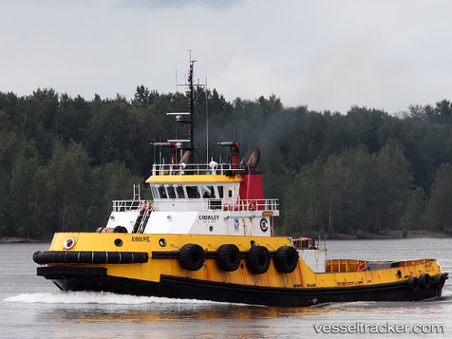
 Aware
Aware
Current Status
Where is the vessel?
Aware is currently in Near Puerta de Tierra, based on AIS data received less than 1h ago.
Latest AIS update:
Current position: 18.44727° N, 66.09005° W (Near Puerta de Tierra)
Average speed (last 7 days): Loading…
Average speed (last 30 days): Loading…
Vessel profile: Aware is a Tug with dimensions 38m x 13m.
This page combines live AIS, route history, probable destination signals, nearby traffic, and port activity for practical vessel monitoring.
The current position of vessel Aware is 18.44727 lat / -66.09005 lng. Updated: 2026-04-24 02:26:41 UTCNearest reference points:
- Near San Juan
- Near Roosevelt Roads
- Near Isabel Segunda
Currently sailing under the flag of USA ![]()
Aware built in 2000 year
Details:
Live Vessel Aware Analytics (details, animations, etc.)
Recent AIS points (UTC):
2026-04-23 22:59:39 UTC · 18.44725, -66.09002 · SOG 0 kn · COG 28°2026-04-24 00:14:38 UTC · 18.44724, -66.09000 · SOG 0 kn · COG 28°
2026-04-24 01:59:41 UTC · 18.44726, -66.09002 · SOG 0 kn · COG 29°
2026-04-24 02:26:41 UTC · 18.44727, -66.09005 · SOG 0 kn · COG 29°