 vesseltracker.com
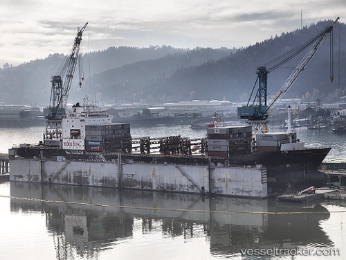
 Matson Tacoma
Current Status
Where is the vessel?
Matson Tacoma is currently in 73 nm SW of Lenard Harbour, based on AIS data received about 1h ago.
Latest AIS update:
Current position: 54.04638° N, 163.43086° W (73 nm SW of Lenard Harbour)
Average speed (last 7 days): Loading…
Average speed (last 30 days): Loading…
Vessel profile: Matson Tacoma is a Container Ship with dimensions 216m x 24m.
This page combines live AIS, route history, probable destination signals, nearby traffic, and port activity for practical vessel monitoring.
The current position of vessel Matson Tacoma is 54.04638 lat / -163.43086 lng. Updated: 2026-05-15 03:48:21 UTCNearest reference points:
- Near Lenard Harbour
Currently sailing under the flag of USA ![]()
Matson Tacoma built in 1987 year
Deadweight:
20668 tDetails:
Live Vessel Matson Tacoma Analytics (details, animations, etc.)
Recent AIS points (UTC):
2026-05-14 21:57:07 UTC · 54.33363, -160.24277 · SOG 14.4 kn · COG 258°2026-05-14 23:04:55 UTC · 54.27667, -160.84666 · SOG 19 kn · COG -1°
2026-05-14 23:30:09 UTC · 54.25591, -161.08092 · SOG 19.7 kn · COG 259°
2026-05-15 03:48:21 UTC · 54.04638, -163.43086 · SOG 19.3 kn · COG 266°