 vesseltracker.com
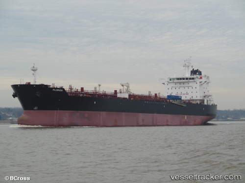
 Florida
Current Status
Where is the vessel?
Florida is currently in Near Kapolei, based on AIS data received less than 1h ago.
Latest AIS update:
Current position: 21.32333° N, 158.11166° W (Near Kapolei)
Average speed (last 7 days): Loading…
Average speed (last 30 days): Loading…
Vessel profile: Florida is a Chemical Oil Products Tanker with dimensions 183m x 181m.
This page combines live AIS, route history, probable destination signals, nearby traffic, and port activity for practical vessel monitoring.
The current position of vessel Florida is 21.32333 lat / -158.11166 lng. Updated: 2026-05-15 04:18:20 UTCNearest reference points:
- Near Honolulu
- Near Kaunakakai
- 132 nm SW of Barbers Point
Currently sailing under the flag of USA ![]()
Florida built in 2013 year
Deadweight:
45760 tDetails:
Live Vessel Florida Analytics (details, animations, etc.)
Recent AIS points (UTC):
2026-05-14 22:14:07 UTC · 21.32392, -158.11263 · SOG 0 kn · COG 224°2026-05-14 23:21:16 UTC · 21.32333, -158.11166 · SOG 0 kn · COG -1°
2026-05-15 03:39:19 UTC · 21.32333, -158.11166 · SOG 0 kn · COG -1°
2026-05-15 04:18:20 UTC · 21.32333, -158.11166 · SOG 0 kn · COG -1°