 vesseltracker.com
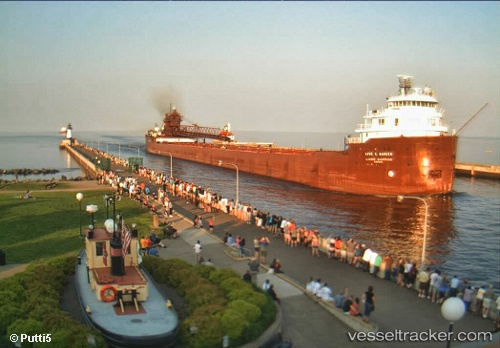
 Kaye E Barker
Current Status
Where is the vessel?
Kaye E Barker is currently in Near Proctor, based on AIS data received less than 1h ago.
Latest AIS update:
Current position: 46.73422° N, 92.08714° W (Near Proctor)
Average speed (last 7 days): Loading…
Average speed (last 30 days): Loading…
Vessel profile: Kaye E Barker is a Self Discharging Bulk Carrier with dimensions 223m x 21m.
This page combines live AIS, route history, probable destination signals, nearby traffic, and port activity for practical vessel monitoring.
The current position of vessel Kaye E Barker is 46.73422 lat / -92.08714 lng. Updated: 2026-05-16 14:16:54 UTCNearest reference points:
- Near La Pointe
Currently sailing under the flag of USA ![]()
Kaye E Barker built in 1952 year
Deadweight:
25345 tDetails:
Live Vessel Kaye E Barker Analytics (details, animations, etc.)
Recent AIS points (UTC):
2026-05-16 10:58:53 UTC · 46.73421, -92.08716 · SOG 0 kn · COG -1°2026-05-16 11:26:59 UTC · 46.73333, -92.08667 · SOG 0 kn · COG -1°
2026-05-16 13:43:53 UTC · 46.73423, -92.08715 · SOG 0 kn · COG -1°
2026-05-16 14:16:54 UTC · 46.73422, -92.08714 · SOG 0 kn · COG -1°