 vesseltracker.com
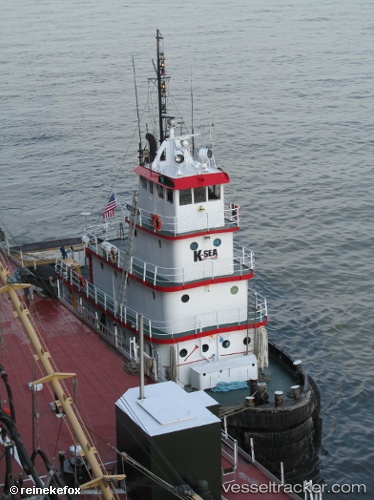
 Liz Vinik
Current Status
Where is the vessel?
Liz Vinik is currently in Near Chrome, based on AIS data received less than 1h ago.
Latest AIS update:
Current position: 40.55833° N, 74.22833° W (Near Chrome)
Average speed (last 7 days): Loading…
Average speed (last 30 days): Loading…
Vessel profile: Liz Vinik is a Tug with dimensions 32m x 10m.
This page combines live AIS, route history, probable destination signals, nearby traffic, and port activity for practical vessel monitoring.
The current position of vessel Liz Vinik is 40.55833 lat / -74.22833 lng. Updated: 2026-05-13 16:16:54 UTCNearest reference points:
- Near Bayway
- Near Elizabethport
- Near South Amboy
Currently sailing under the flag of USA ![]()
Liz Vinik built in 1962 year
Details:
Live Vessel Liz Vinik Analytics (details, animations, etc.)
Recent AIS points (UTC):
2026-05-13 13:19:57 UTC · 40.55974, -74.22959 · SOG 0 kn · COG 118°2026-05-13 13:19:57 UTC · 40.55974, -74.22959 · SOG 0 kn · COG 118°
2026-05-13 16:01:53 UTC · 40.55833, -74.22833 · SOG 0 kn · COG -1°
2026-05-13 16:16:54 UTC · 40.55833, -74.22833 · SOG 0 kn · COG -1°