 vesseltracker.com
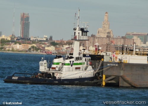
 Nanticoke
Current Status
Where is the vessel?
Nanticoke is currently in Near Colwyn, based on AIS data received about 1h ago.
Latest AIS update:
Current position: 39.89333° N, 75.20167° W (Near Colwyn)
Average speed (last 7 days): Loading…
Average speed (last 30 days): Loading…
Vessel profile: Nanticoke is a Pusher Tug with dimensions 34m x 11m.
This page combines live AIS, route history, probable destination signals, nearby traffic, and port activity for practical vessel monitoring.
The current position of vessel Nanticoke is 39.89333 lat / -75.20167 lng. Updated: 2026-05-14 02:12:28 UTCNearest reference points:
- Near Brooklawn
- Near Trainer
- Near Wilmington
Currently sailing under the flag of USA ![]()
Nanticoke built in 2005 year
Deadweight:
364 tDetails:
Live Vessel Nanticoke Analytics (details, animations, etc.)
Recent AIS points (UTC):
2026-05-13 23:00:59 UTC · 39.89370, -75.20329 · SOG 0 kn · COG 279°2026-05-14 00:19:01 UTC · 39.89371, -75.20331 · SOG 0 kn · COG 280°
2026-05-14 01:40:10 UTC · 39.89368, -75.20330 · SOG 0 kn · COG 282°
2026-05-14 02:12:28 UTC · 39.89333, -75.20167 · SOG 0 kn · COG -1°