 vesseltracker.com
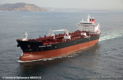
Garden State
Current StatusWhere is the vessel?
Garden State is currently in 56 nm W of Indian Rocks Beach, based on AIS data received about 3h ago.
Latest AIS update:
Current position: 27.60847° N, 83.86343° W (56 nm W of Indian Rocks Beach)
Average speed (last 7 days): Loading…
Average speed (last 30 days): Loading…
Vessel profile: Garden State is a Chemical Oil Products Tanker with dimensions 32m x 186m.
This page combines live AIS, route history, probable destination signals, nearby traffic, and port activity for practical vessel monitoring.
The current position of vessel Garden State is 27.60847 lat / -83.86343 lng. Updated: 2026-05-13 16:07:46 UTCNearest reference points:
- 62 nm SW of Anna Maria
- 58 nm SW of Suwannee
- Near Tierra Verde
Details:
Live Vessel Garden State Analytics (details, animations, etc.)
Recent AIS points (UTC):
2026-05-13 13:23:25 UTC · 27.59774, -83.12639 · SOG 14.3 kn · COG 269°2026-05-13 14:32:17 UTC · 27.59990, -83.43381 · SOG 14.4 kn · COG 269°
2026-05-13 16:07:46 UTC · 27.60847, -83.86343 · SOG 14.7 kn · COG 278°
2026-05-13 16:07:46 UTC · 27.60847, -83.86343 · SOG 14.7 kn · COG 278°