 vesseltracker.com
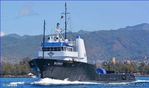
Nunui
Current StatusWhere is the vessel?
Nunui is currently in 110 nm SW of Enyu Airfield, Bikini, based on AIS data received about 1h ago.
Latest AIS update:
Current position: 10.45231° N, 164.01395° E (110 nm SW of Enyu Airfield, Bikini)
Average speed (last 7 days): Loading…
Average speed (last 30 days): Loading…
Vessel profile: Nunui is a Offshore Tug Supply Ship with dimensions 14m x 52m.
This page combines live AIS, route history, probable destination signals, nearby traffic, and port activity for practical vessel monitoring.
The current position of vessel Nunui is 10.45231 lat / 164.01395 lng. Updated: 2026-05-14 20:04:50 UTCDetails:
Live Vessel Nunui Analytics (details, animations, etc.)
Recent AIS points (UTC):
2026-05-14 16:23:20 UTC · 10.20482, 164.47476 · SOG 8.4 kn · COG -1°2026-05-14 17:49:41 UTC · 10.31150, 164.30988 · SOG 8.3 kn · COG -1°
2026-05-14 19:04:43 UTC · 10.38983, 164.15097 · SOG 8.9 kn · COG -1°
2026-05-14 20:04:50 UTC · 10.45231, 164.01395 · SOG 8.9 kn · COG -1°