 vesseltracker.com
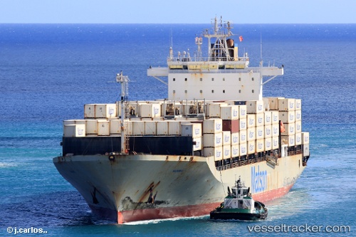
Maunawili
Current StatusWhere is the vessel?
Maunawili is currently in 33 nm W of Tatoosh Island, based on AIS data received less than 1h ago.
Latest AIS update:
Current position: 48.31687° N, 125.56214° W (33 nm W of Tatoosh Island)
Average speed (last 7 days): Loading…
Average speed (last 30 days): Loading…
Vessel profile: Maunawili is a Container Ship with dimensions 32m x 217m.
This page combines live AIS, route history, probable destination signals, nearby traffic, and port activity for practical vessel monitoring.
The current position of vessel Maunawili is 48.31687 lat / -125.56214 lng. Updated: 2026-05-15 04:38:16 UTCNearest reference points:
- 21 nm NW of Tatoosh Island
- Near Clallam Bay
- Near Powell River
Details:
Live Vessel Maunawili Analytics (details, animations, etc.)
Recent AIS points (UTC):
2026-05-15 00:06:41 UTC · 47.30566, -127.65854 · SOG 22.9 kn · COG 52°2026-05-15 01:20:12 UTC · 47.58667, -127.11500 · SOG 22 kn · COG -1°
2026-05-15 03:23:52 UTC · 48.05611, -126.16104 · SOG 23.4 kn · COG 53°
2026-05-15 04:38:16 UTC · 48.31687, -125.56214 · SOG 22.2 kn · COG 57°