 vesseltracker.com
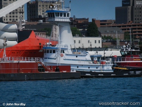
 Denali
Current Status
Where is the vessel?
Denali is currently in Near Maher Terminal, based on AIS data received about 1h ago.
Latest AIS update:
Current position: 40.64429° N, 74.11403° W (Near Maher Terminal)
Average speed (last 7 days): Loading…
Average speed (last 30 days): Loading…
Vessel profile: Denali is a Tug with dimensions 152m x 24m.
This page combines live AIS, route history, probable destination signals, nearby traffic, and port activity for practical vessel monitoring.
The current position of vessel Denali is 40.64429 lat / -74.11403 lng. Updated: 2026-04-28 17:23:56 UTCNearest reference points:
- Near Maher Terminal
- Near Port Ivory/Staten Isl/New York
- Near Tompkinsville
Currently sailing under the flag of USA ![]()
Denali built in 2010 year
Deadweight:
278 tDetails:
Live Vessel Denali Analytics (details, animations, etc.)
Recent AIS points (UTC):
2026-04-28 14:00:43 UTC · 40.64333, -74.11333 · SOG 0 kn · COG -1°2026-04-28 16:18:45 UTC · 40.64333, -74.11333 · SOG 0 kn · COG -1°
2026-04-28 16:26:55 UTC · 40.64431, -74.11386 · SOG 0 kn · COG 51°
2026-04-28 17:23:56 UTC · 40.64429, -74.11403 · SOG 0 kn · COG 51°