 vesseltracker.com
 Teresa
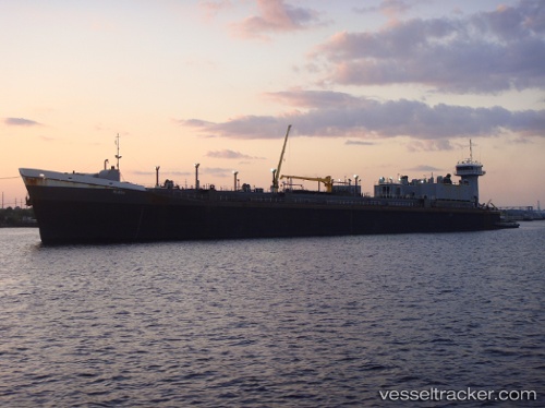
Current Status
Where is the vessel?
Teresa is currently in Near Golfo Aranci, based on AIS data received about 260d ago.
Latest AIS update:
Current position: 41.07411° N, 9.55217° E (Near Golfo Aranci)
Average speed (last 7 days): Loading…
Average speed (last 30 days): Loading…
Vessel profile: Teresa is a Pusher Tug with dimensions 181m x 23m.
This page combines live AIS, route history, probable destination signals, nearby traffic, and port activity for practical vessel monitoring.
The current position of vessel Teresa is 41.07411 lat / 9.55217 lng. Updated: 2025-08-06 15:59:08 UTCNearest reference points:
- Near Golfo Aranci
- Near Olbia
- Near La Maddalena
Currently sailing under the flag of USA ![]()
Teresa built in 1997 year
Deadweight:
625 tDetails:
Live Vessel Teresa Analytics (details, animations, etc.)
Recent AIS points (UTC):
2025-08-06 15:59:08 UTC · 41.07411, 9.55217 · SOG 1.2 kn · COG -1°