 vesseltracker.com
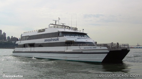
 NANTUCKET_EXPRESS
Current Status
Where is the vessel?
NANTUCKET_EXPRESS is currently in Near VINEYARD HAVEN, based on AIS data received less than 1h ago.
Latest AIS update:
Current position: 41.47157° N, 70.58016° W (Near VINEYARD HAVEN)
Average speed (last 7 days): Loading…
Average speed (last 30 days): Loading…
Vessel profile: NANTUCKET_EXPRESS is a Passengers Ship with dimensions m x m.
This page combines live AIS, route history, probable destination signals, nearby traffic, and port activity for practical vessel monitoring.
The current position of vessel NANTUCKET_EXPRESS is 41.47157 lat / -70.58016 lng. Updated: 2026-04-30 21:36:00 UTCNearest reference points:
- Near VINEYARD HAVEN
- Near FAIRHAVEN
- Near Barnstable
Currently sailing under the flag of United States ![]()
Details:
Live Vessel NANTUCKET_EXPRESS Analytics (details, animations, etc.)
Recent AIS points (UTC):
2026-04-30 18:03:59 UTC · 41.63128, -70.91196 · SOG 7.5 kn · COG 138°2026-04-30 19:17:22 UTC · 41.45585, -70.59800 · SOG 2.3 kn · COG 93°
2026-04-30 19:17:22 UTC · 41.45585, -70.59800 · SOG 2.3 kn · COG 93°
2026-04-30 21:36:00 UTC · 41.47157, -70.58016 · SOG 2.7 kn · COG 226°