 vesseltracker.com
 Liberty Peace
Current Status
Where is the vessel?
Liberty Peace is currently in 106 nm S of Jonesville, based on AIS data received about 1h ago.
Latest AIS update:
Current position: 37.92655° N, 52.82220° W (106 nm S of Jonesville)
Average speed (last 7 days): Loading…
Average speed (last 30 days): Loading…
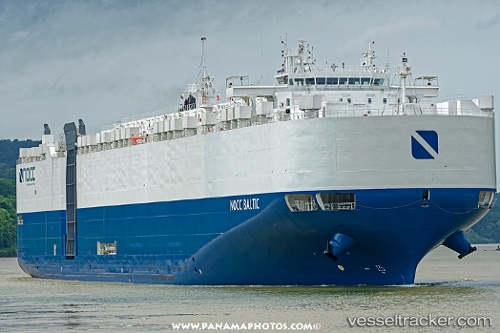
Vessel profile: Liberty Peace is a Vehicles Carrier with dimensions 199m x 199m.
This page combines live AIS, route history, probable destination signals, nearby traffic, and port activity for practical vessel monitoring.
The current position of vessel Liberty Peace is 37.92655 lat / -52.82220 lng. Updated: 2026-04-26 02:08:43 UTCNearest reference points:
- 44 nm SE of Jonesville
- 153 nm S of Jonesville
- 76 nm SW of Seica
Currently sailing under the flag of USA ![]()
Details:
Live Vessel Liberty Peace Analytics (details, animations, etc.)
Recent AIS points (UTC):
2026-04-25 22:54:43 UTC · 37.72898, -53.82064 · SOG 15.5 kn · COG 72°2026-04-25 23:22:43 UTC · 37.75845, -53.67512 · SOG 14.9 kn · COG 73°
2026-04-26 01:44:43 UTC · 37.90160, -52.95078 · SOG 15.3 kn · COG 67°
2026-04-26 02:08:43 UTC · 37.92655, -52.82220 · SOG 15.8 kn · COG 68°