 vesseltracker.com
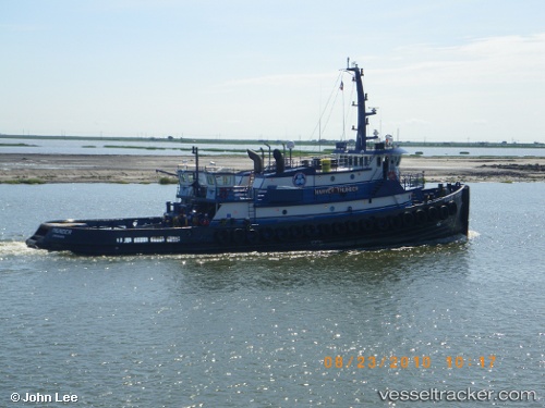
Signet Thunder
Current StatusWhere is the vessel?
Signet Thunder is currently in Near Jacksonville, based on AIS data received about 1h ago.
Latest AIS update:
Current position: 30.32388° N, 81.62612° W (Near Jacksonville)
Average speed (last 7 days): Loading…
Average speed (last 30 days): Loading…
Vessel profile: Signet Thunder is a [tug.offshore_tug_supply] with dimensions 11m x 38m.
This page combines live AIS, route history, probable destination signals, nearby traffic, and port activity for practical vessel monitoring.
The current position of vessel Signet Thunder is 30.32388 lat / -81.62612 lng. Updated: 2026-04-30 18:03:28 UTCNearest reference points:
- Near Jacksonville
- Near Ponte Vedra
- Near Fernandina
Details:
Live Vessel Signet Thunder Analytics (details, animations, etc.)
Recent AIS points (UTC):
2026-04-30 14:02:49 UTC · 30.32384, -81.62613 · SOG 0 kn · COG 99°2026-04-30 16:10:30 UTC · 30.32386, -81.62612 · SOG 0 kn · COG 99°
2026-04-30 16:22:10 UTC · 30.32387, -81.62613 · SOG 0 kn · COG 99°
2026-04-30 18:03:28 UTC · 30.32388, -81.62612 · SOG 0 kn · COG 98°