 vesseltracker.com
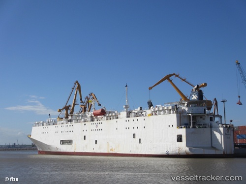
 Polaris 2
Current Status
Where is the vessel?
Polaris 2 is currently in Near Maltepe, based on AIS data received about 1h ago.
Latest AIS update:
Current position: 40.78872° N, 28.98250° E (Near Maltepe)
Average speed (last 7 days): Loading…
Average speed (last 30 days): Loading…
Vessel profile: Polaris 2 is a Livestock Carrier with dimensions 149m x 23m.
This page combines live AIS, route history, probable destination signals, nearby traffic, and port activity for practical vessel monitoring.
The current position of vessel Polaris 2 is 40.78872 lat / 28.98250 lng. Updated: 2026-05-02 12:25:22 UTCNearest reference points:
- 10 nm SE of Kumport
- Near Kumport
- Near Maltepe
Currently sailing under the flag of Panama ![]()
Polaris 2 built in 1986 year
Deadweight:
8443 tDetails:
Live Vessel Polaris 2 Analytics (details, animations, etc.)
Recent AIS points (UTC):
2026-05-02 08:04:11 UTC · 40.76990, 28.65653 · SOG 6.4 kn · COG -1°2026-05-02 10:24:32 UTC · 40.78785, 28.97895 · SOG 1.5 kn · COG -1°
2026-05-02 11:00:21 UTC · 40.77072, 28.97978 · SOG 1.9 kn · COG -1°
2026-05-02 12:25:22 UTC · 40.78872, 28.98250 · SOG 9.7 kn · COG -1°