 vesseltracker.com
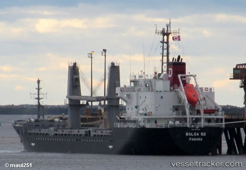
 Balsa 92
Current Status
Where is the vessel?
Balsa 92 is currently in 130 nm S of Port Eads, based on AIS data received less than 1h ago.
Latest AIS update:
Current position: 26.93810° N, 88.43877° W (130 nm S of Port Eads)
Average speed (last 7 days): Loading…
Average speed (last 30 days): Loading…
Vessel profile: Balsa 92 is a General Cargo Ship with dimensions 106m x 106m.
This page combines live AIS, route history, probable destination signals, nearby traffic, and port activity for practical vessel monitoring.
The current position of vessel Balsa 92 is 26.93810 lat / -88.43877 lng. Updated: 2026-04-26 15:34:18 UTCNearest reference points:
- Near Pilottown
- 13 nm NE of Pilottown
- Near Port Fourchon
Currently sailing under the flag of Panama ![]()
Balsa 92 built in 2013 year
Deadweight:
7733 tDetails:
Live Vessel Balsa 92 Analytics (details, animations, etc.)
Recent AIS points (UTC):
2026-04-26 09:58:44 UTC · 28.83184, -89.42815 · SOG 11 kn · COG 183°2026-04-26 09:58:44 UTC · 28.83184, -89.42815 · SOG 11 kn · COG 183°
2026-04-26 09:58:44 UTC · 28.83184, -89.42815 · SOG 11 kn · COG 183°
2026-04-26 15:34:18 UTC · 26.93810, -88.43877 · SOG 11.4 kn · COG 155°