 vesseltracker.com
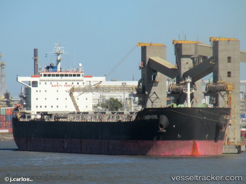
 Sea Empire
Current Status
Where is the vessel?
Sea Empire is currently in 19 nm W of Bayuquan, based on AIS data received less than 1h ago.
Latest AIS update:
Current position: 40.23421° N, 121.69781° E (19 nm W of Bayuquan)
Average speed (last 7 days): Loading…
Average speed (last 30 days): Loading…
Vessel profile: Sea Empire is a Bulk Carrier with dimensions 229m x 32m.
This page combines live AIS, route history, probable destination signals, nearby traffic, and port activity for practical vessel monitoring.
The current position of vessel Sea Empire is 40.23421 lat / 121.69781 lng. Updated: 2026-05-14 13:14:58 UTCNearest reference points:
- 15 nm W of Bayuquan
- Near Bayuquan
- 17 nm SW of PANJIN
Currently sailing under the flag of Panama ![]()
Sea Empire built in 2010 year
Deadweight:
79372 tDetails:
Live Vessel Sea Empire Analytics (details, animations, etc.)
Recent AIS points (UTC):
2026-05-14 10:29:05 UTC · 40.23083, 121.69663 · SOG 0 kn · COG 70°2026-05-14 10:59:05 UTC · 40.23080, 121.69677 · SOG 0 kn · COG 67°
2026-05-14 11:56:05 UTC · 40.23077, 121.69718 · SOG 0 kn · COG 60°
2026-05-14 13:14:58 UTC · 40.23421, 121.69781 · SOG 0.2 kn · COG 129°