 vesseltracker.com
 FAHRIYE K
Current Status
Where is the vessel?
FAHRIYE K is currently in Near Varna, based on AIS data received about 1h ago.
Latest AIS update:
Current position: 43.19340° N, 27.91448° E (Near Varna)
Average speed (last 7 days): Loading…
Average speed (last 30 days): Loading…
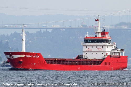
Vessel profile: FAHRIYE K is a General Cargo Ship with dimensions 89m x 13m.
This page combines live AIS, route history, probable destination signals, nearby traffic, and port activity for practical vessel monitoring.
The current position of vessel FAHRIYE K is 43.19340 lat / 27.91448 lng. Updated: 2026-03-29 05:32:55 UTCNearest reference points:
- Near Varna
- Near Ignatievo
- Near Beloslav
Currently sailing under the flag of Panama ![]()
FAHRIYE K built in 2007 year
Deadweight:
4581 tDetails:
Live Vessel FAHRIYE K Analytics (details, animations, etc.)
Recent AIS points (UTC):
2026-03-28 23:23:53 UTC · 43.19345, 27.91468 · SOG 0 kn · COG 274°2026-03-29 01:05:51 UTC · 43.19343, 27.91437 · SOG 0 kn · COG 274°
2026-03-29 04:05:51 UTC · 43.19345, 27.91450 · SOG 0 kn · COG 274°
2026-03-29 05:32:55 UTC · 43.19340, 27.91448 · SOG 0 kn · COG 274°