 vesseltracker.com
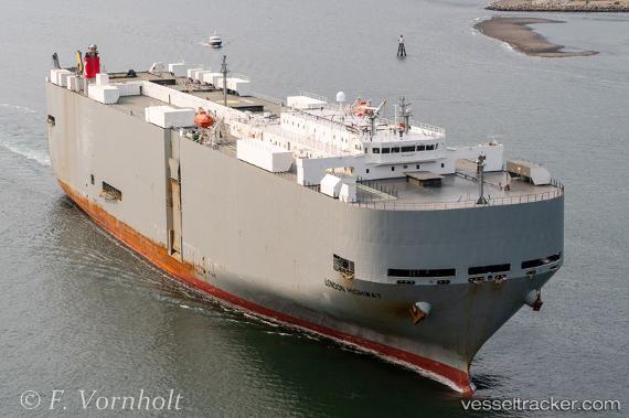
London Highway
Current StatusWhere is the vessel?
London Highway is currently in 81 nm SE of Raichur, based on AIS data received about 1h ago.
Latest AIS update:
Current position: 14.96084° N, 76.80800° W (81 nm SE of Raichur)
Average speed (last 7 days): Loading…
Average speed (last 30 days): Loading…
Vessel profile: London Highway is a Vehicles Carrier with dimensions 32m x 199m.
This page combines live AIS, route history, probable destination signals, nearby traffic, and port activity for practical vessel monitoring.
The current position of vessel London Highway is 14.96084 lat / -76.80800 lng. Updated: 2026-05-15 17:29:11 UTCDetails:
Live Vessel London Highway Analytics (details, animations, etc.)
Recent AIS points (UTC):
2026-05-15 13:48:57 UTC · 14.18881, -77.26469 · SOG 14.5 kn · COG 38°2026-05-15 14:18:55 UTC · 14.29592, -77.20670 · SOG 14.8 kn · COG 31°
2026-05-15 14:18:55 UTC · 14.29592, -77.20670 · SOG 14.8 kn · COG 31°
2026-05-15 17:29:11 UTC · 14.96084, -76.80800 · SOG 14.6 kn · COG 31°