 vesseltracker.com
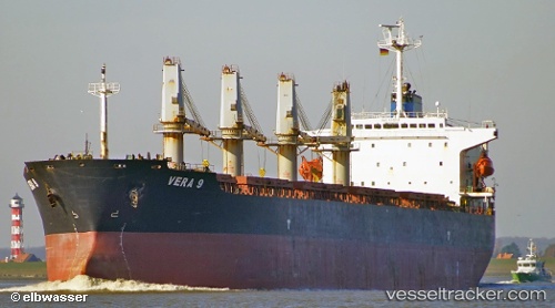
Era S
Current StatusWhere is the vessel?
Era S is currently in Near KO SICHANG, based on AIS data received about 1h ago.
Latest AIS update:
Current position: 13.19224° N, 100.84657° E (Near KO SICHANG)
Average speed (last 7 days): Loading…
Average speed (last 30 days): Loading…
Vessel profile: Era S is a Bulk Carrier with dimensions 31m x 190m.
This page combines live AIS, route history, probable destination signals, nearby traffic, and port activity for practical vessel monitoring.
The current position of vessel Era S is 13.19224 lat / 100.84657 lng. Updated: 2026-04-16 19:46:45 UTCNearest reference points:
- Near SIRACHA
- Near Sriracha
- Near KO SICHANG
Details:
Live Vessel Era S Analytics (details, animations, etc.)
Recent AIS points (UTC):
2026-04-16 12:01:37 UTC · 13.19219, 100.84696 · SOG 0 kn · COG 192°2026-04-16 14:16:38 UTC · 13.19135, 100.84505 · SOG 0 kn · COG 117°
2026-04-16 15:55:38 UTC · 13.19217, 100.84706 · SOG 0 kn · COG 197°
2026-04-16 19:46:45 UTC · 13.19224, 100.84657 · SOG 0 kn · COG 181°