 vesseltracker.com
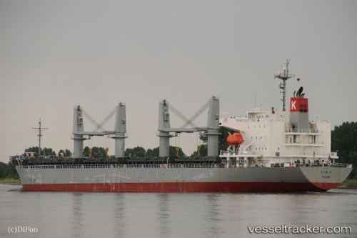
Elm K
Current StatusWhere is the vessel?
Elm K is currently in Near Oakland, based on AIS data received less than 1h ago.
Latest AIS update:
Current position: 37.70972° N, 122.31656° W (Near Oakland)
Average speed (last 7 days): Loading…
Average speed (last 30 days): Loading…
Vessel profile: Elm K is a General Cargo Ship with dimensions 28m x 181m.
This page combines live AIS, route history, probable destination signals, nearby traffic, and port activity for practical vessel monitoring.
The current position of vessel Elm K is 37.70972 lat / -122.31656 lng. Updated: 2026-05-01 22:48:00 UTCNearest reference points:
- Near Oakland
- Near Treasure Island/Los Angeles
- Near San Francisco
Details:
Live Vessel Elm K Analytics (details, animations, etc.)
Recent AIS points (UTC):
2026-05-01 19:32:59 UTC · 37.70716, -122.31578 · SOG 0 kn · COG 314°2026-05-01 19:50:56 UTC · 37.70723, -122.31556 · SOG 0.1 kn · COG 310°
2026-05-01 21:47:57 UTC · 37.70911, -122.31530 · SOG 0 kn · COG 239°
2026-05-01 22:48:00 UTC · 37.70972, -122.31656 · SOG 0.2 kn · COG 207°