 vesseltracker.com
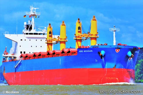
 Nord Missouri
Current Status
Where is the vessel?
Nord Missouri is currently in 16 nm E of Island View, based on AIS data received less than 1h ago.
Latest AIS update:
Current position: 29.90180° S, 31.33852° E (16 nm E of Island View)
Average speed (last 7 days): Loading…
Average speed (last 30 days): Loading…
Vessel profile: Nord Missouri is a Bulk Carrier with dimensions 200m x 32m.
This page combines live AIS, route history, probable destination signals, nearby traffic, and port activity for practical vessel monitoring.
The current position of vessel Nord Missouri is -29.90180 lat / 31.33852 lng. Updated: 2026-04-28 01:23:19 UTCNearest reference points:
- Near Umhlanga Rocks
- Near Island View
- Near Durban
Currently sailing under the flag of Panama ![]()
Details:
Live Vessel Nord Missouri Analytics (details, animations, etc.)
Recent AIS points (UTC):
2026-04-27 21:29:19 UTC · -29.84964, 31.33060 · SOG 0.3 kn · COG 125°2026-04-27 22:38:19 UTC · -29.85546, 31.33300 · SOG 1.6 kn · COG 182°
2026-04-28 00:17:08 UTC · -29.89225, 31.33683 · SOG 0.4 kn · COG 110°
2026-04-28 01:23:19 UTC · -29.90180, 31.33852 · SOG 0.7 kn · COG 130°