 vesseltracker.com
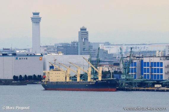
Boracay Island
Current StatusWhere is the vessel?
Boracay Island is currently in 34 nm SW of Minachi, based on AIS data received about 1h ago.
Latest AIS update:
Current position: 33.30613° N, 135.39165° E (34 nm SW of Minachi)
Average speed (last 7 days): Loading…
Average speed (last 30 days): Loading…
Vessel profile: Boracay Island is a General Cargo Ship with dimensions 31m x 180m.
This page combines live AIS, route history, probable destination signals, nearby traffic, and port activity for practical vessel monitoring.
The current position of vessel Boracay Island is 33.30613 lat / 135.39165 lng. Updated: 2026-05-14 06:28:32 UTCNearest reference points:
- 40 nm SW of Minachi
- 18 nm SE of Gobo Wakayama
- 23 nm S of Minachi
Details:
Live Vessel Boracay Island Analytics (details, animations, etc.)
Recent AIS points (UTC):
2026-05-14 01:45:23 UTC · 33.27333, 135.29666 · SOG 2 kn · COG -1°2026-05-14 03:39:23 UTC · 33.28667, 135.38333 · SOG 2 kn · COG -1°
2026-05-14 04:09:25 UTC · 33.29167, 135.40833 · SOG 2 kn · COG -1°
2026-05-14 06:28:32 UTC · 33.30613, 135.39165 · SOG 8.8 kn · COG 267°