 vesseltracker.com
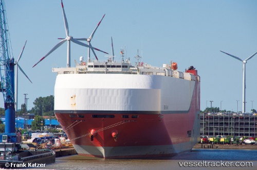
 Orion Highway
Current Status
Where is the vessel?
Orion Highway is currently in Near Dar es Salaam, based on AIS data received less than 1h ago.
Latest AIS update:
Current position: 6.72277° S, 39.34387° E (Near Dar es Salaam)
Average speed (last 7 days): Loading…
Average speed (last 30 days): Loading…
Vessel profile: Orion Highway is a Vehicles Carrier with dimensions 199m x 37m.
This page combines live AIS, route history, probable destination signals, nearby traffic, and port activity for practical vessel monitoring.
The current position of vessel Orion Highway is -6.72277 lat / 39.34387 lng. Updated: 2026-05-15 13:40:04 UTCNearest reference points:
- Near Dar Es Salaam
Currently sailing under the flag of Panama ![]()
Details:
Live Vessel Orion Highway Analytics (details, animations, etc.)
Recent AIS points (UTC):
2026-05-15 09:40:04 UTC · -6.72337, 39.34313 · SOG 0.2 kn · COG 130°2026-05-15 10:25:04 UTC · -6.72332, 39.34303 · SOG 0.5 kn · COG 103°
2026-05-15 11:40:04 UTC · -6.72326, 39.34328 · SOG 0.6 kn · COG 109°
2026-05-15 13:40:04 UTC · -6.72277, 39.34387 · SOG 0.9 kn · COG 117°