 vesseltracker.com
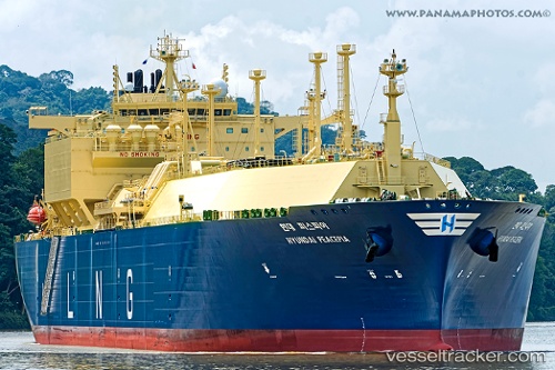
Hyundai Peacepia
Current StatusWhere is the vessel?
Hyundai Peacepia is currently in 32 nm SW of Yucatan Channel, based on AIS data received about 1h ago.
Latest AIS update:
Current position: 21.39018° N, 85.37685° W (32 nm SW of Yucatan Channel)
Average speed (last 7 days): Loading…
Average speed (last 30 days): Loading…
Vessel profile: Hyundai Peacepia is a Lng Tanker with dimensions 46m x 295m.
This page combines live AIS, route history, probable destination signals, nearby traffic, and port activity for practical vessel monitoring.
The current position of vessel Hyundai Peacepia is 21.39018 lat / -85.37685 lng. Updated: 2026-05-15 05:41:28 UTCNearest reference points:
- 58 nm S of San Julian
- Near Puerto Juárez
Details:
Live Vessel Hyundai Peacepia Analytics (details, animations, etc.)
Recent AIS points (UTC):
2026-05-14 23:21:42 UTC · 22.87704, -86.36483 · SOG 16.8 kn · COG 153°2026-05-15 03:55:40 UTC · 21.73975, -85.74294 · SOG 16.8 kn · COG 151°
2026-05-15 04:10:07 UTC · 21.67896, -85.71016 · SOG 17 kn · COG 151°
2026-05-15 05:41:28 UTC · 21.39018, -85.37685 · SOG 16.6 kn · COG 129°