 vesseltracker.com
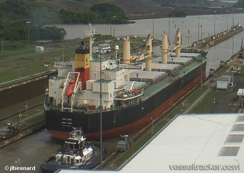
Em Ruby
Current StatusWhere is the vessel?
Em Ruby is currently in Near Hilongos, based on AIS data received less than 1h ago.
Latest AIS update:
Current position: 10.34963° N, 124.59977° E (Near Hilongos)
Average speed (last 7 days): Loading…
Average speed (last 30 days): Loading…
Vessel profile: Em Ruby is a Bulk Carrier with dimensions 32m x 190m.
This page combines live AIS, route history, probable destination signals, nearby traffic, and port activity for practical vessel monitoring.
The current position of vessel Em Ruby is 10.34963 lat / 124.59977 lng. Updated: 2026-05-16 17:26:19 UTCNearest reference points:
- Near Hilongos
- 16 nm E of Danao
- Near Danao
Details:
Live Vessel Em Ruby Analytics (details, animations, etc.)
Recent AIS points (UTC):
2026-05-16 14:20:32 UTC · 10.82460, 124.20917 · SOG 13 kn · COG 179°2026-05-16 16:12:27 UTC · 10.48727, 124.37204 · SOG 12.8 kn · COG 125°
2026-05-16 16:44:47 UTC · 10.42334, 124.46841 · SOG 12.8 kn · COG 126°
2026-05-16 17:26:19 UTC · 10.34963, 124.59977 · SOG 13 kn · COG 115°