 vesseltracker.com
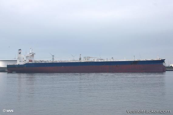
Amjad
Current StatusWhere is the vessel?
Amjad is currently in Near Ayn Sukhnah, based on AIS data received less than 1h ago.
Latest AIS update:
Current position: 29.48667° N, 32.47333° E (Near Ayn Sukhnah)
Average speed (last 7 days): Loading…
Average speed (last 30 days): Loading…
Vessel profile: Amjad is a Crude Oil Tanker with dimensions 60m x 333m.
This page combines live AIS, route history, probable destination signals, nearby traffic, and port activity for practical vessel monitoring.
The current position of vessel Amjad is 29.48667 lat / 32.47333 lng. Updated: 2026-05-15 19:05:21 UTCNearest reference points:
- Near Ras Sudr
- Near Al Adabiyah
- Near AL ADABIYAH
Details:
Live Vessel Amjad Analytics (details, animations, etc.)
Recent AIS points (UTC):
2026-05-15 16:02:25 UTC · 29.48667, 32.47167 · SOG 0 kn · COG -1°2026-05-15 16:02:25 UTC · 29.48667, 32.47167 · SOG 0 kn · COG -1°
2026-05-15 17:35:21 UTC · 29.48667, 32.47333 · SOG 0 kn · COG -1°
2026-05-15 19:05:21 UTC · 29.48667, 32.47333 · SOG 0 kn · COG -1°