 vesseltracker.com
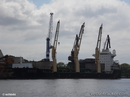
 BAHRI RIYADH
Current Status
Where is the vessel?
BAHRI RIYADH is currently in 43 nm W of Vescovato, based on AIS data received less than 1h ago.
Latest AIS update:
Current position: 42.60551° N, 10.38680° W (43 nm W of Vescovato)
Average speed (last 7 days): Loading…
Average speed (last 30 days): Loading…
Vessel profile: BAHRI RIYADH is a Cargo with dimensions m x m.
This page combines live AIS, route history, probable destination signals, nearby traffic, and port activity for practical vessel monitoring.
The current position of vessel BAHRI RIYADH is 42.60551 lat / -10.38680 lng. Updated: 2026-04-23 13:51:58 UTCNearest reference points:
- 40 nm NW of Sarinena
- 11 nm S of Sarinena
- Near Portosin
Currently sailing under the flag of Saudi Arabia ![]()
Details:
Live Vessel BAHRI RIYADH Analytics (details, animations, etc.)
Recent AIS points (UTC):
2026-04-23 09:44:43 UTC · 43.15827, -10.25788 · SOG 12.1 kn · COG 182°2026-04-23 10:52:27 UTC · 42.94398, -10.32099 · SOG 11.6 kn · COG 207°
2026-04-23 11:23:25 UTC · 42.88785, -10.35847 · SOG 2 kn · COG 200°
2026-04-23 13:51:58 UTC · 42.60551, -10.38680 · SOG 11.5 kn · COG 188°