 vesseltracker.com
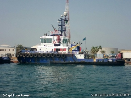
Mv Maharah
Current StatusWhere is the vessel?
Mv Maharah is currently in Near Ras Tannurah, based on AIS data received less than 1h ago.
Latest AIS update:
Current position: 26.65685° N, 50.19036° E (Near Ras Tannurah)
Average speed (last 7 days): Loading…
Average speed (last 30 days): Loading…
Vessel profile: Mv Maharah is a Tug with dimensions 12m x 37m.
This page combines live AIS, route history, probable destination signals, nearby traffic, and port activity for practical vessel monitoring.
The current position of vessel Mv Maharah is 26.65685 lat / 50.19036 lng. Updated: 2026-04-28 09:53:51 UTCNearest reference points:
- Near DAMMAM
- Near Ad Dammam
- Near Sayhat
Details:
Live Vessel Mv Maharah Analytics (details, animations, etc.)
Recent AIS points (UTC):
2026-04-28 06:13:12 UTC · 26.64889, 50.17754 · SOG 0.5 kn · COG 303°2026-04-28 07:21:39 UTC · 26.64996, 50.16923 · SOG 3.7 kn · COG 289°
2026-04-28 08:12:51 UTC · 26.65030, 50.16899 · SOG 0.9 kn · COG 254°
2026-04-28 09:53:51 UTC · 26.65685, 50.19036 · SOG 0.4 kn · COG 9°